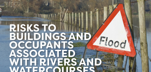
Risks to buildings and occupants associated with rivers and watercourses.
Are we taking the risk of flooding seriously enough?
Author: Hilary Grayson BSc EST MAN (Hons), Director, Sava
Proximity to rivers and watercourses can pose certain risks to buildings, particularly in times of heavy rain. These risks can be further exacerbated when considering the implications of hidden or redirected water courses which only take water in extreme conditions. This article explores some of those potential risks and asks if surveyors should advise clients differently in times of more extreme weather events brought on by climate change.
Buildings located near rivers or watercourses may be vulnerable to flooding during periods of heavy rainfall or when rivers overflow their banks. River flooding (also known as fluvial flooding) occurs when a watercourse cannot cope with the water draining into it from the surrounding land.
Climate change has made devastating flood events more likely. The UK’s first Climate Change Risk Assessment (CCRA), published in 2012, reported that the risk is likely to increase with more water in rivers following extreme weather events and the predicted rise in sea level.
In January 2024, the University of Southampton announced they had been awarded a £6.5million fund to launch a new flood research and training centre. The news article describes how “Currently one in six households in the UK are located in flood-prone areas”, and states the biggest drivers of flooding are increased river flow, surface runoff, storm surges and waves which are compounded by climate change and shifting populations. The new hub will allow scientists to improve their understanding of flooding using advanced monitoring and new forms of computer modelling, artificial intelligence, and machine learning to map and forecast future flooding risks.
If a property is flooded from a river, what are the issues that may occur?
Flooding from a river can be simply a ‘gentle’ overflow onto adjacent land, but often river flood events are accompanied by an increase in the flow of water which can cause extensive damage to structures – think bridges being washed away – and lead to loss of life. If a river can wash a bridge away, it also has the potential to cause extreme damage to foundations, walls, and floors. If it does not actually damage the structure itself, the force of flowing water can lead to erosion around a building’s foundation, which will compromise its stability.

Figure 1: Visible damage to footpath adjacent to the River Great Ouse following flooding event.
As well as damage to buildings, there is also ‘damage’ to occupants. River floodwaters can be contaminated with sewage, chemicals, and other hazardous substances, posing a potential health risk to occupants and potentially causing additional damage to building materials and electrical systems. Luckily, as far as human health is concerned, river flooding in the UK is not usually associated with ‘major health events’ such as cholera outbreaks.
Such severe health risks are usually most associated when a flooding event results in a mass migration of people. In 2006, the World Health Organisation (WHO) published a Flooding and Communicable Disease fact sheet which reported that risks associated with water-borne diseases related to flooding are low unless there is a significant displacement of the population, or the original water sources are compromised by the flooding.
That said, the consequences should not be ignored. Harmful pathogens might be very rare in UK flooding events, but at the very least basic levels of hygiene will need to be improved and areas avoided until the flood material has been cleaned up.
However, human health is not just impacted by waterborne pathogens. There are other health implications such as:
• Injury from floating or concealed debris
• Drowning
• Mental health issues
• Injury from electrical incidents (electrocution or fire)
• Carbon monoxide poisoning from an inappropriate use of generators.
One final health implication to consider for both the occupants and the property is the exacerbated risk of mould growth. If flood water is not promptly and properly cleaned up, it can lead to prolonged moisture exposure to the fabric of the building. This is likely to provide the correct environment for mould growth within the building materials and mould, albeit different species, can be damaging for buildings and people.
Water and electricity
When water gets into electrical systems it can be extremely dangerous and for the following reasons.
Electrical Conductivity: Water is a very good conductor of electricity which means that an electric current can flow through it. If water comes into contact with live electricity, it can potentially lead to electric shock or electrocution.
Short Circuits: If water comes into contact with electrical wires or connections, it can cause a short circuit where the electricity bypasses its intended path and flows directly from the positive side to the negative side of a power source. This can lead to overheating, fires, and damage to electrical equipment.
Damage to electrical equipment: As well as the risk of short circuits, when water gets inside electrical equipment it can corrode metal parts, which in turn will disrupt circuits, and render the equipment non-functional and potentially dangerous.
Fire Hazard: If water contacts electrical outlets or switches, it can increase the risk of fire. It can do this because it reduces the resistance in electrical circuits causing overheating and sparking. This can ignite flammable materials nearby.
Flooding can be dangerous and damaging to electrical systems and appliances, so it is essential to turn off the electricity supply during a flooding event to prevent electrical accidents.
The hidden costs of flooding
What can easily be forgotten is the longer-term impact of flooding on the mental health and well-being of those affected, which can be severe. In July 2022, the UK government published a summary of health implications relating to flooding. It reported that the English National Cohort Study of Flooding and Health found that people who had experienced flooding were more likely to have symptoms of post-traumatic stress disorder (PTSD), depression, and anxiety between six months to three years following the event. It also found that the extent of the impact on mental health was affected by the levels of the floodwater and how long the floodwater stayed in the home.
The visible cost of flooding
Flooding can cause extensive damage to properties which can be extremely costly and time-consuming for property owners and insurers to repair.
However, it is not just the damage that is expensive. It has been estimated that the flooding in 2015/16 cost the economy £1.6 billion. The economic losses from flooding between November 2019 and March 2020 are, in turn, estimated to be about £333 million. These costs have been derived from the analysis of the impact of flooding on properties and businesses (source https://www.gov.uk/government/news/counting-the-costs-of-flooding).
Properties located in flood-prone areas may face higher insurance premiums or even difficulty obtaining insurance protection in the first place. Understanding flood risk and taking appropriate measures to mitigate it can help manage insurance costs. However, where a location is particularly at risk of flooding, insurance can be expensive or even, in some cases, unobtainable. This is where the Flood Re Scheme comes in.
The Flood Re Scheme is a joint initiative between the UK insurance industry and the UK government. It was established by the Water Act 2014 and its purpose is to improve the affordability and availability of flood insurance for residential properties at high risk of flooding.
Hidden water courses
The problem with hidden water courses is in the name – they are hidden or ‘lost’ and that means their potential for wreaking unsuspected havoc is all the greater.
The Victorian and Edwardian urbanisation of cities and towns often lead to the diversion and culverting of rivers and brooks. Our industrialist forefathers considered waterways an inconvenience unless they were directly used in industrial processes or to remove waste. Hence many were often diverted underground. In some cases, this was essential as rapid population growth without the supporting modern infrastructure meant that open urban waterways often became open sewers.
Probably the most well-documented of the lost rivers are those in London that would have been tributaries of the Thames, with the best known of these being the Fleet. Now completely lost from view, the Fleet is part of London’s sewer network. However, London is not the only city to have ‘lost rivers’.
Manchester’s River Medlock was channelled into brick culverts and built over but has now been partially restored as part of the development of the new Mayfield Park. While this project was driven by public amenity and environmental objectives, releasing the river from its straitjacket will, according to engineers, help manage flood risk in the city centre.
The importance of desktop research
There may be a variety of reasons for considering a particular property; for purchase by your own organisation if you are a housing provider; on behalf of a private purchaser if you are a surveyor offering buyers surveys; or on behalf of an investor. Whatever the reason, the key to assessing the risk of flooding is through diligent desktop research.
The government has a website where you can explore the risks of a particular site: https://flood-map-for-planning.service.gov.uk/. With a postcode or grid reference, you can assess the risk of a property being subject to flooding based on a location’s chance of flooding from rivers or the sea in any year. The risk profiles do not consider other sources of flooding or future risks, so just because a property is in Zone 1 – the lowest risk – doesn’t mean it can’t still flood in the future.
There is also an additional site that includes more detailed information at a granular property level: https://www.gov.uk/check-long-term-flood-risk. This gives a wider risk profile from a variety of water sources.
It must be remembered, however, that these flood risk maps show just that, risk, and cannot be relied upon. For example, Totnes is interesting in this respect because the Environment Agency flood mapping shows that much of the downtown area is at high risk, but this does not take into account the fact that the Environment Agency has installed flood defences that have largely been successful at keeping river water at bay in recent years. That said, these defences have not been entirely successful and have been breached (slightly) several times.
The Environment Agency mapping is not an absolute guide as to what will happen, but it should not be ignored.
The other place to check is old maps, which provide a useful insight into previous uses of the land and can illustrate if local water courses have ‘disappeared’. If, when looking at old maps, there is a suggestion that a stream has ‘gone’, it is a fair assumption to make that it will have been rerouted or potentially sent underground.
It is possible that there could be a conflict between the information on the government risk map and old maps – you know there is a hidden river, but the risk map does not indicate a risk of flooding.
This is a tricky situation, and no one has a crystal ball. This is where local knowledge is essential – knowing that a car park is liable to flooding in heavy rain, for example, could indicate a possible problem that the Environment Agency has not picked up. One surveyor contacted as part of our research commented that while they use the Environment Agency/Government flood maps, they also supplement these with local knowledge. For example, flood defences were built in this surveyor’s town a few years ago and they comment specifically where a property is in an area where the defences have been less effective.
Has the risk of flooding increased?
The Royal Meteorological Society (rMetS) published a ‘Graphical Abstract’ in July 2023, which provides a summary of the UK’s weather and climate for 2022. It presents this together with the historical context for a number of essential climate variables.
rMetS produces annual ‘State of the UK Climate’ publications which provide an accessible, authoritative, and up-to-date assessment of UK climate trends, variations and extremes based on the most up-to-date observational datasets of climate quality.
We remember July 2022 for the record-breaking temperatures, but when considering rainfall, the headlines for 2022 were that in that year rainfall was 94% of the 1991–2020 average, which included the UK’s eighth wettest February on record (although it should be noted that January, March, April, July and August were all notably dry, particularly across England and Wales, and that in fact, the UK had its driest summer since 1995).
The report noted that five of the 10 wettest years for the UK in a series from 1836 have occurred in the 21st century and that since 2009, the UK has experienced its wettest February, April, June, November and December on record in monthly series from 1836 – 5 of 12 months – as well as its two wettest winters.
It also reports that the most recent decade (2013–2022) UK winters have been 10% wetter than 1991–2020 and 25% wetter than 1961–1990, with much smaller changes for spring, summer and autumn overall and there has been a slight increase in heavy rainfall across the UK in recent decades.
But dig a bit deeper and you can find that the winter of 2013/14 was the wettest since records began in 1910 and of the top ten wettest winters, four have occurred since 2007 and seven since 1990.
December 2015 was the wettest December on record and the wettest calendar month overall since records began in 1910. And this year, according to provisional Met Office statistics, Northern Ireland had its wettest July on record (in a series which dates from 1836).
And of course, there are the winter storms we now experience. The rainfall from Storm Desmond in 2015 broke records when Honister in Cumbria, received 341mm (13.4 in) within 24 hours, breaking the previous November 2009 record of 316.4mm.
Overall, RMetS concludes that the UK’s climate continues to change. The recent decades have been warmer, wetter, and sunnier than the 20th century and there has been a slight increase in heavy rainfall across the UK. Also, following Storm Desmond, a report submitted to IOPscience, an online service for journal content published by IOP Publishing, concluded that climate change increases the probability of heavy rains in Northern England/Southern Scotland like those of Storm Desmond.
How should surveyors assess and report the risks to ensure they are not liable?
If the risks are changing, then should the way we behave also change? This statement would be correct for other areas so is surely true for researching, inspecting, and reporting on enhanced risks to property from extreme weather events triggered by climate change.
We asked a few surveyors about the way they have adapted their professional service because of such risks. The general responses were that:
- They do have a different approach to desktop research than that of, say, 10 years ago
- While the Government/Environment Agency’s flood risk maps are good, local knowledge is essential because you can interpret the local geology and history
- All the surveyors questioned said that it is essential that they are aware of hidden water courses in their localities and the potential risks they may pose, and report those risks to clients
- All the surveyors questioned said that it is essential to ensure they advise clients on how important it is to have the correct buildings and contents insurance.
Fundamentally, the view was that it is the surveyors’ job to have a crystal ball and that ignoring river flood risk associated with climate change is not an option.
Hilary Grayson BSc EST MAN(Hons)

Hilary is focused on developing new qualifications, as well as Sava’s activities within residential surveying. Hilary has a wealth of experience within the built environment, including commercial property, local government and working at RICS.